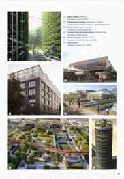
*Intensification van industrial estates
An inspiration guide for the province of Utrecht
Business has always been an important part of the urban dynamics and determined the cityscape, such as the market square, the quay and the high street.
The industrial revolution meant an increase in scale of mechanized companies, which led to a formal separation of 'urban' urban activities and industrial activity.
In the post-war period, more heavy industry was moved to Asia and Eastern Europe, the manufacturing industry is now returning to the Netherlands
All these developments also apply to Utrecht with specific business park characteristics and high ambitions regarding sustainability, greening, circularity and quality of life.
In addition, the provincial spatial quality has the ambition to accommodate as much intensification as possible, so that the landscape is spared and money can be spent for new developments to improve existing sites.
The intensification task of industrial estates is broader than strictly the site itself. After all, these multifunctional areas also play a role in regional transitions and developments regarding the economy, quality of life, climate, energy and biodiversity.
Intensification is therefore about more than just adding a built-up area of mixed functions.
The Province of Utrecht is conducting research into the intensification of its working landscapes using a design research, economic combination and regional strategy. How could we meet the current demand for industrial space, complete and with quality, on existing industrial estates?
projectrole | design, research, illustrations
Collaboration: PARK Utrecht, Vereniging Deltametropool, Rebel, Buro013, Studio Redd, Studio Space Architecten
Client: Provincie Utrecht
Text: Vereniging Deltametropool
Period 2020-2021
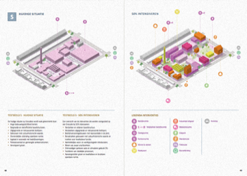
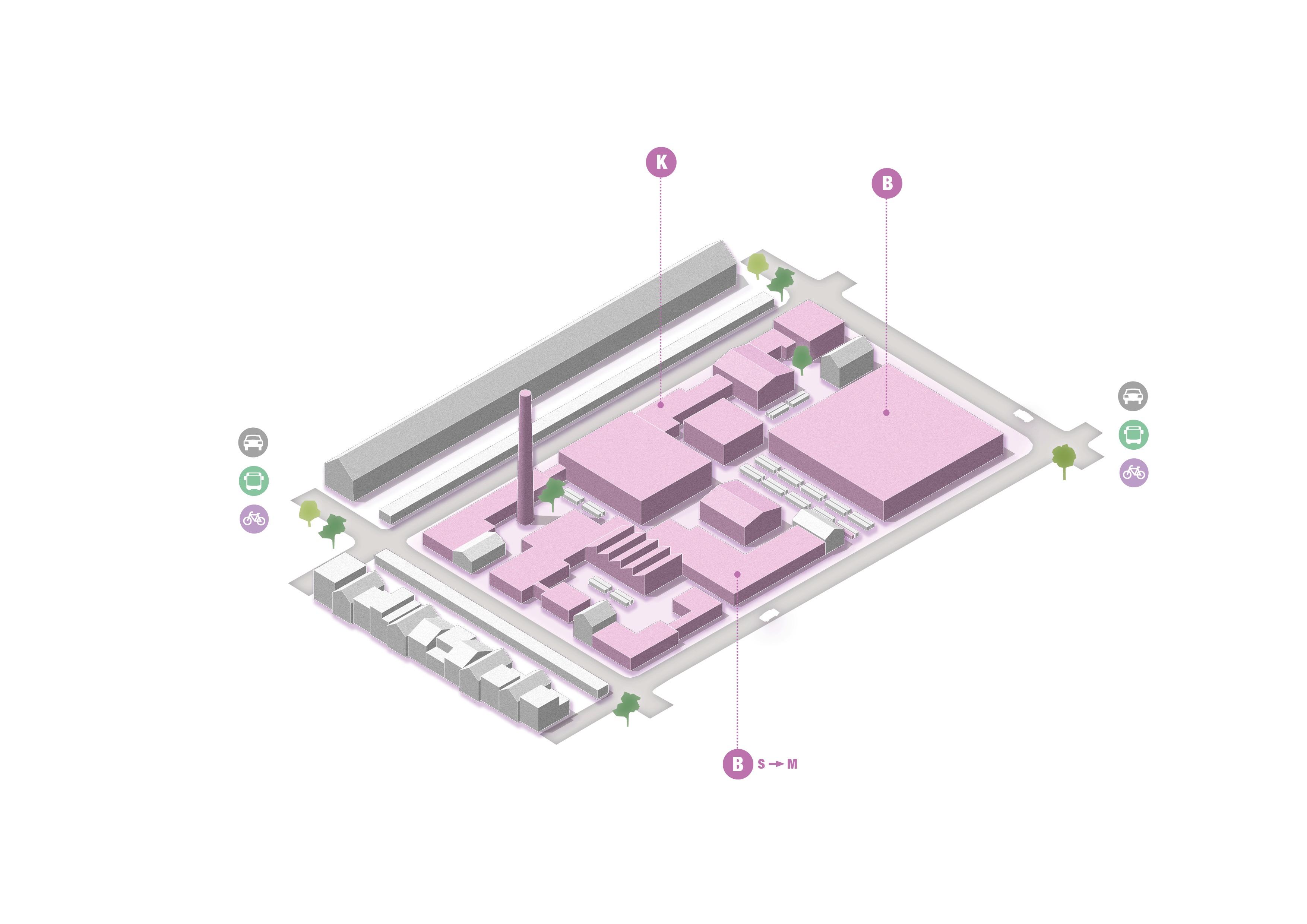
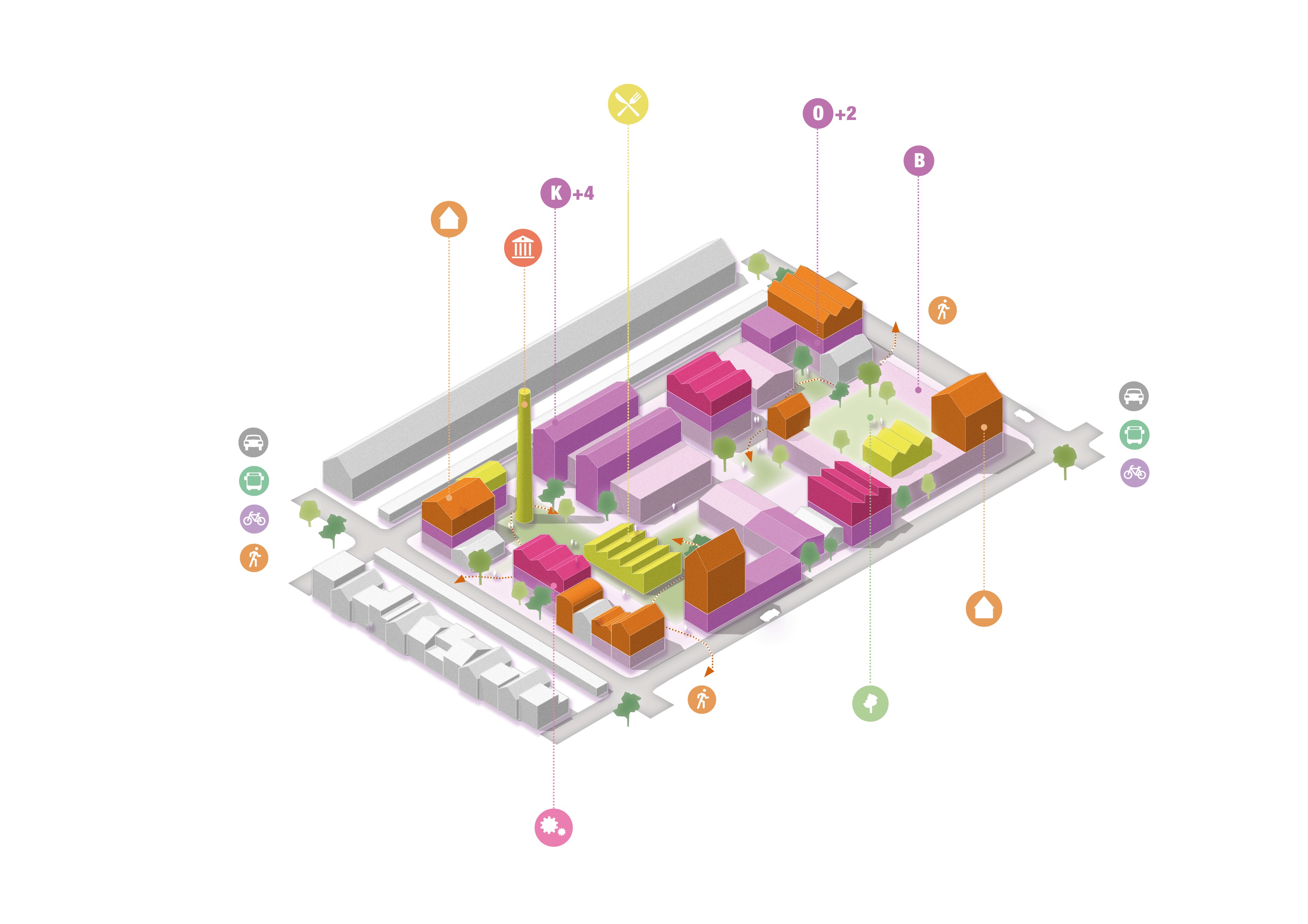
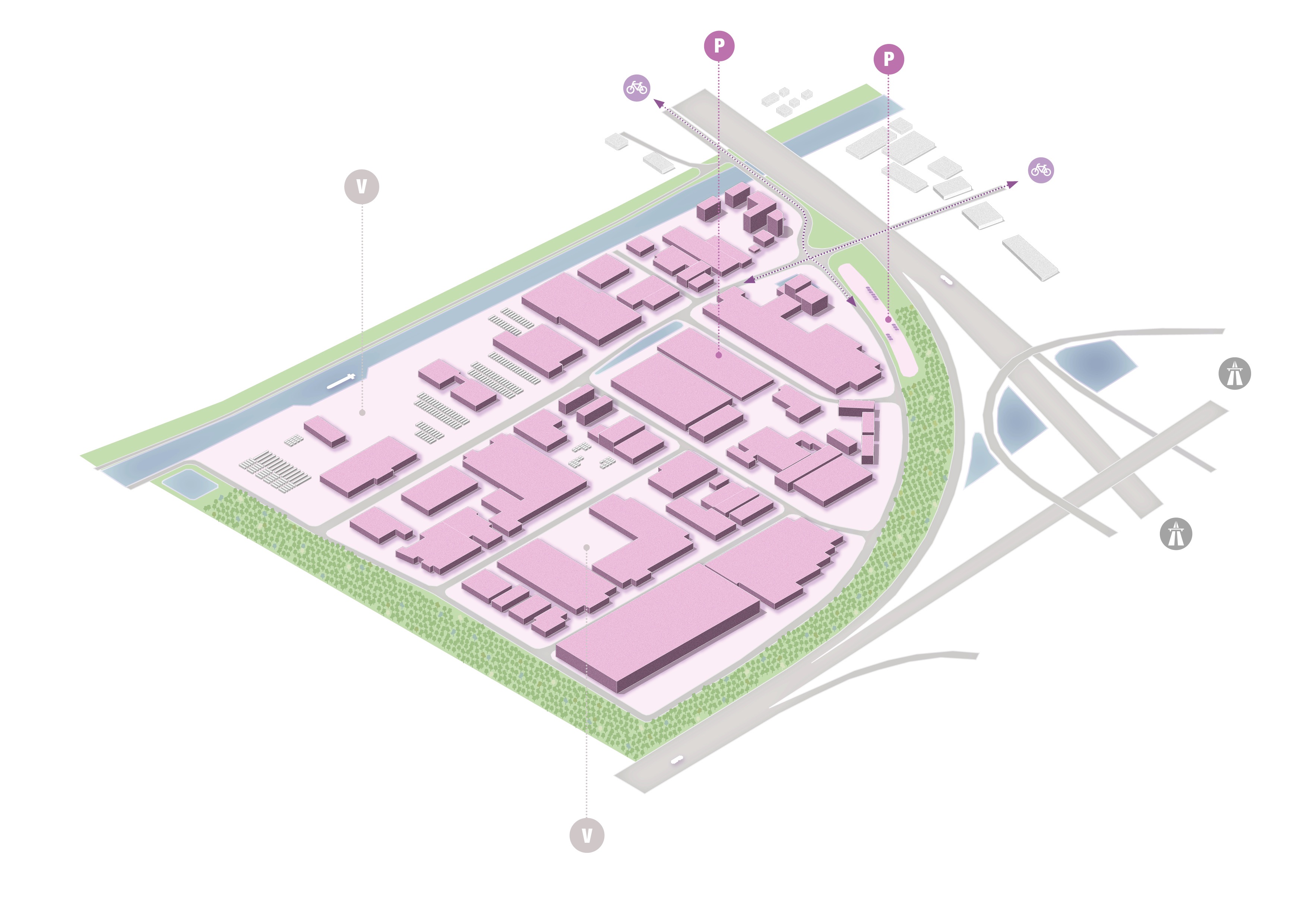
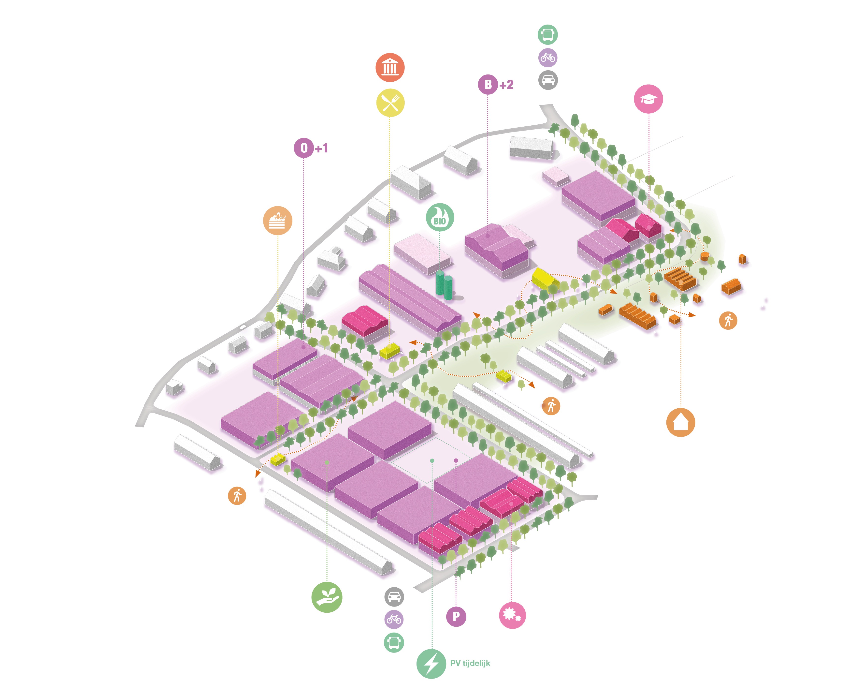
*Schematic isometric view of an industrial area, suggested with new socialcultural, economic interventions,
categorized as type M:
These locations often have cultural-historical value and offer potential for education and a sustainable design, such as a practical lab or test field for enterprising farmers, who can market their regional products from this location. Due to its location, there is a lot of potential for linking with the urban or village fabric.
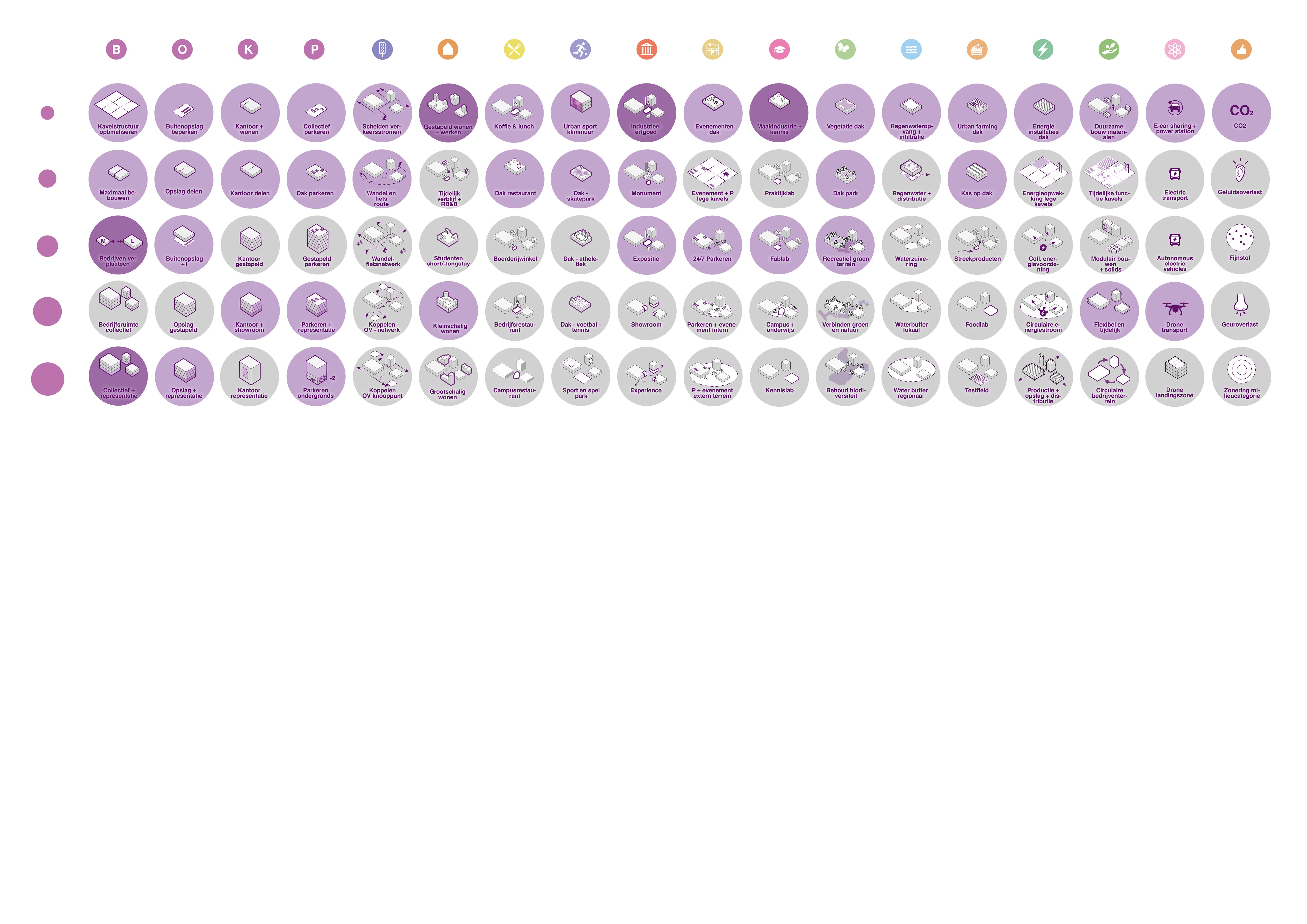
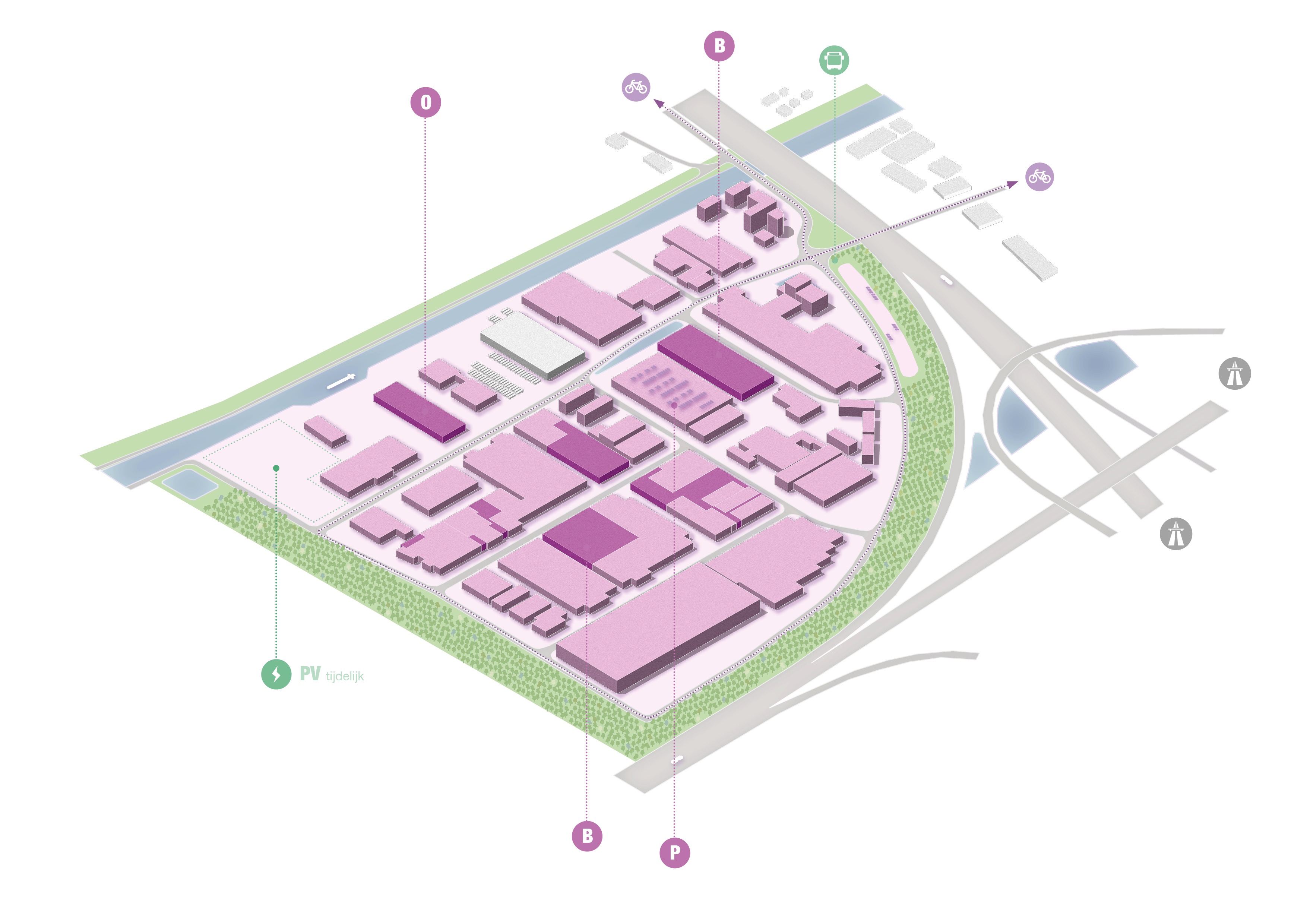
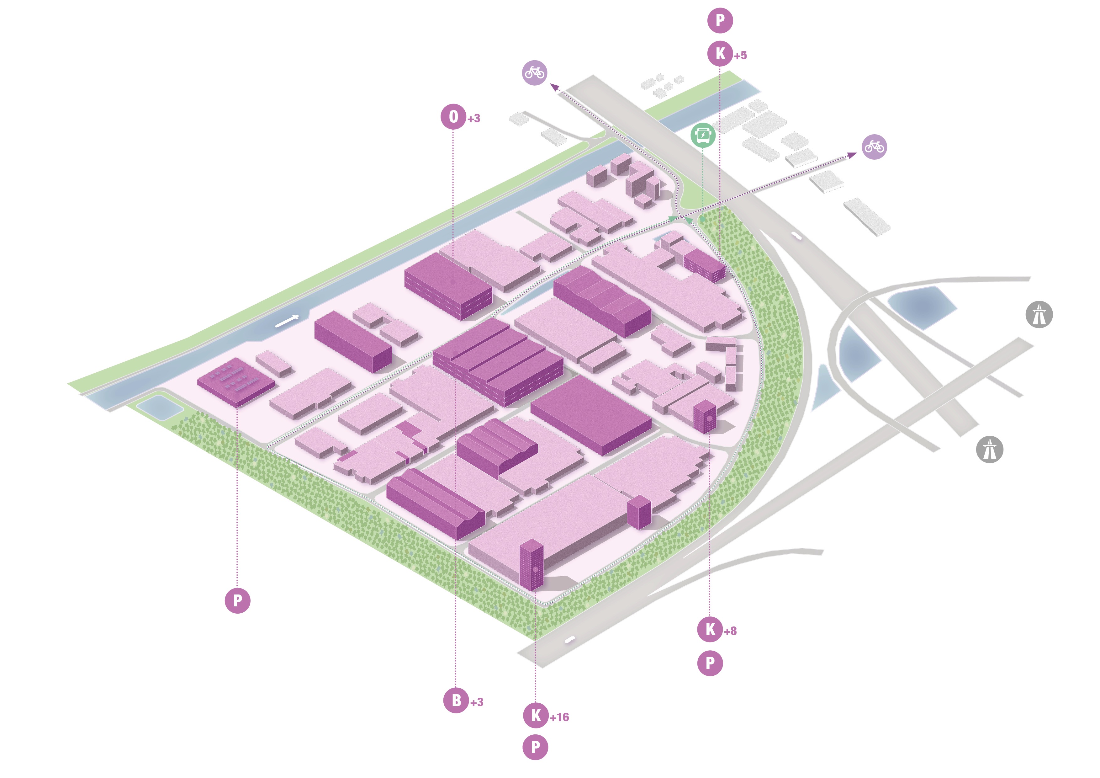
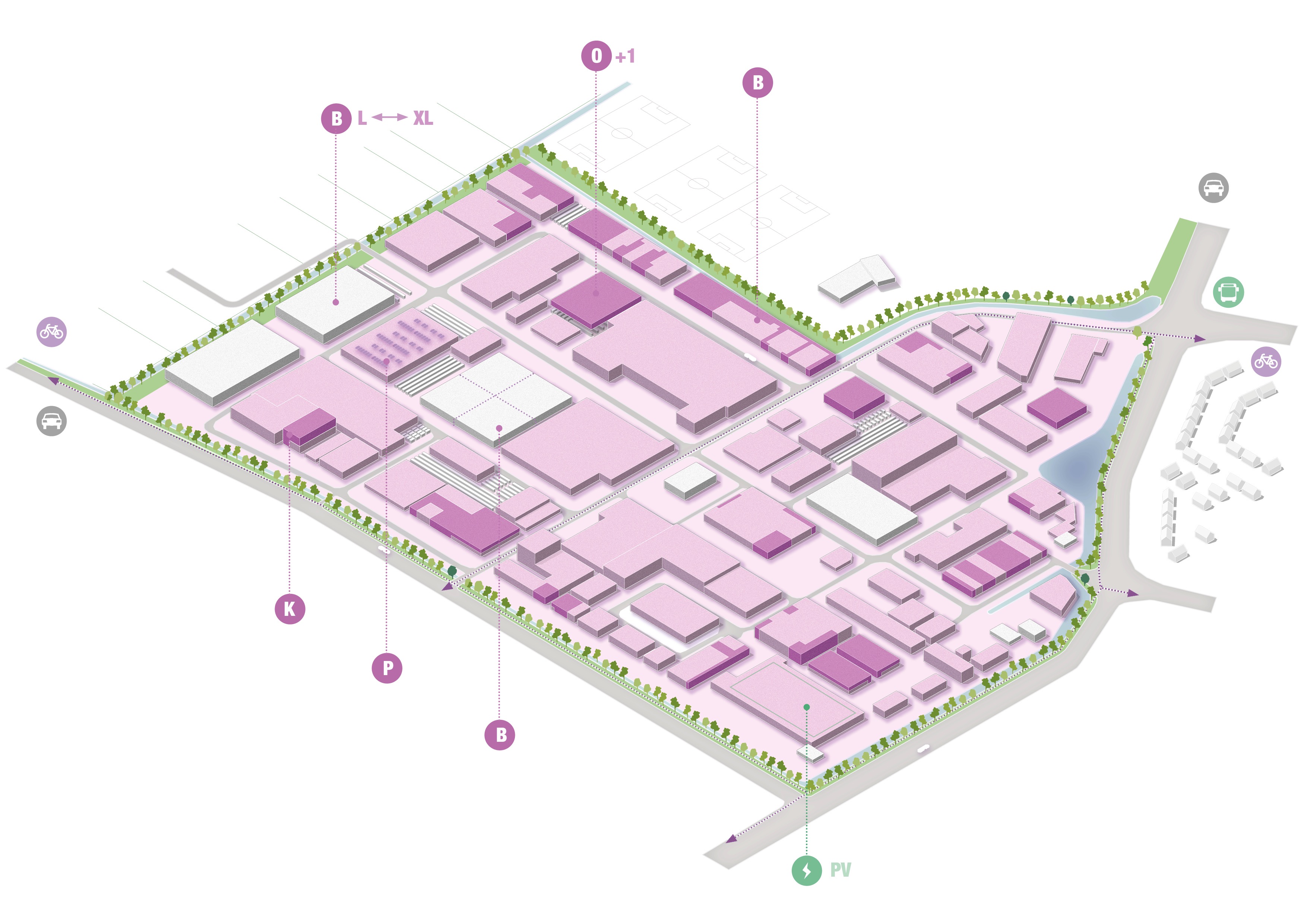
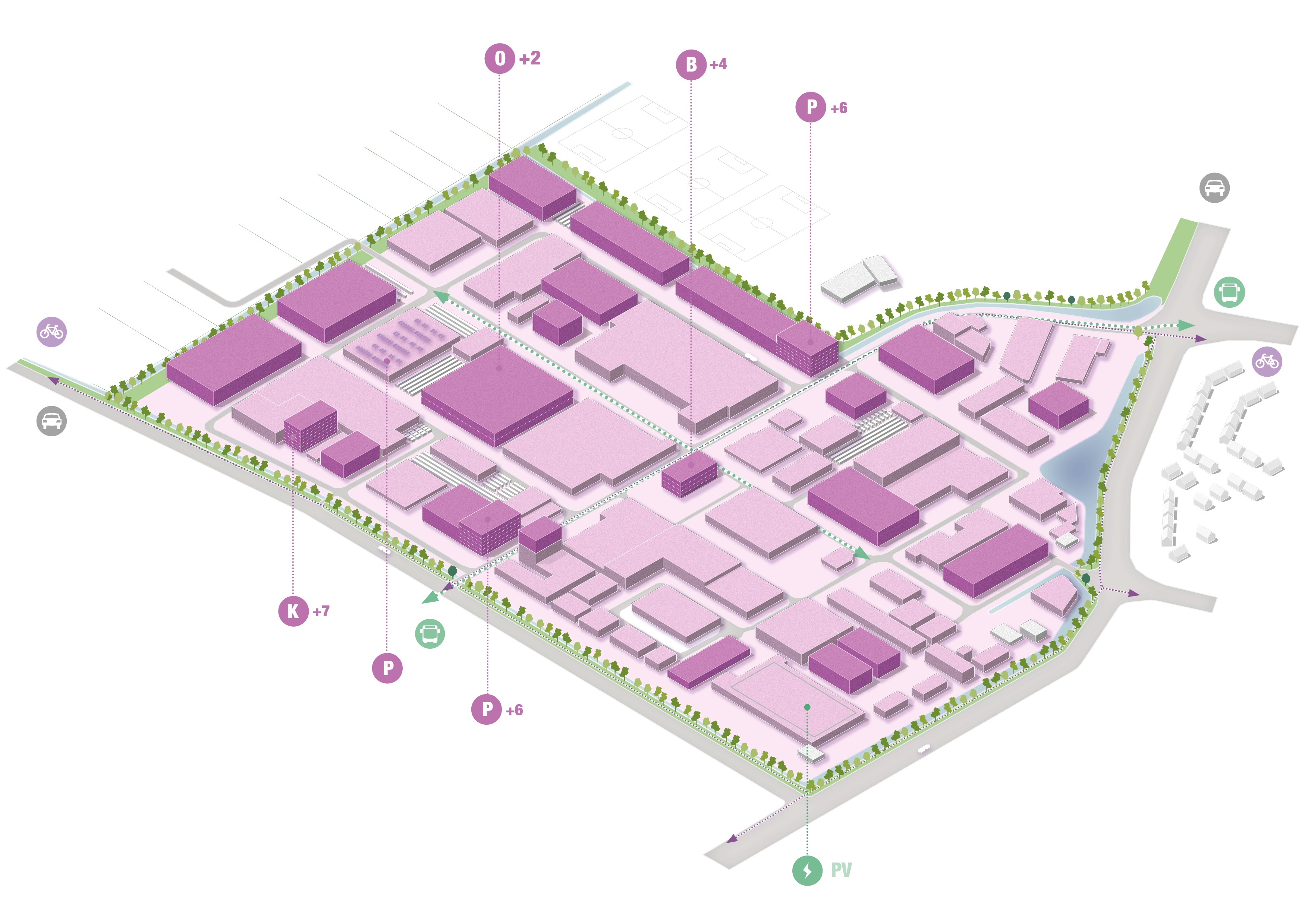
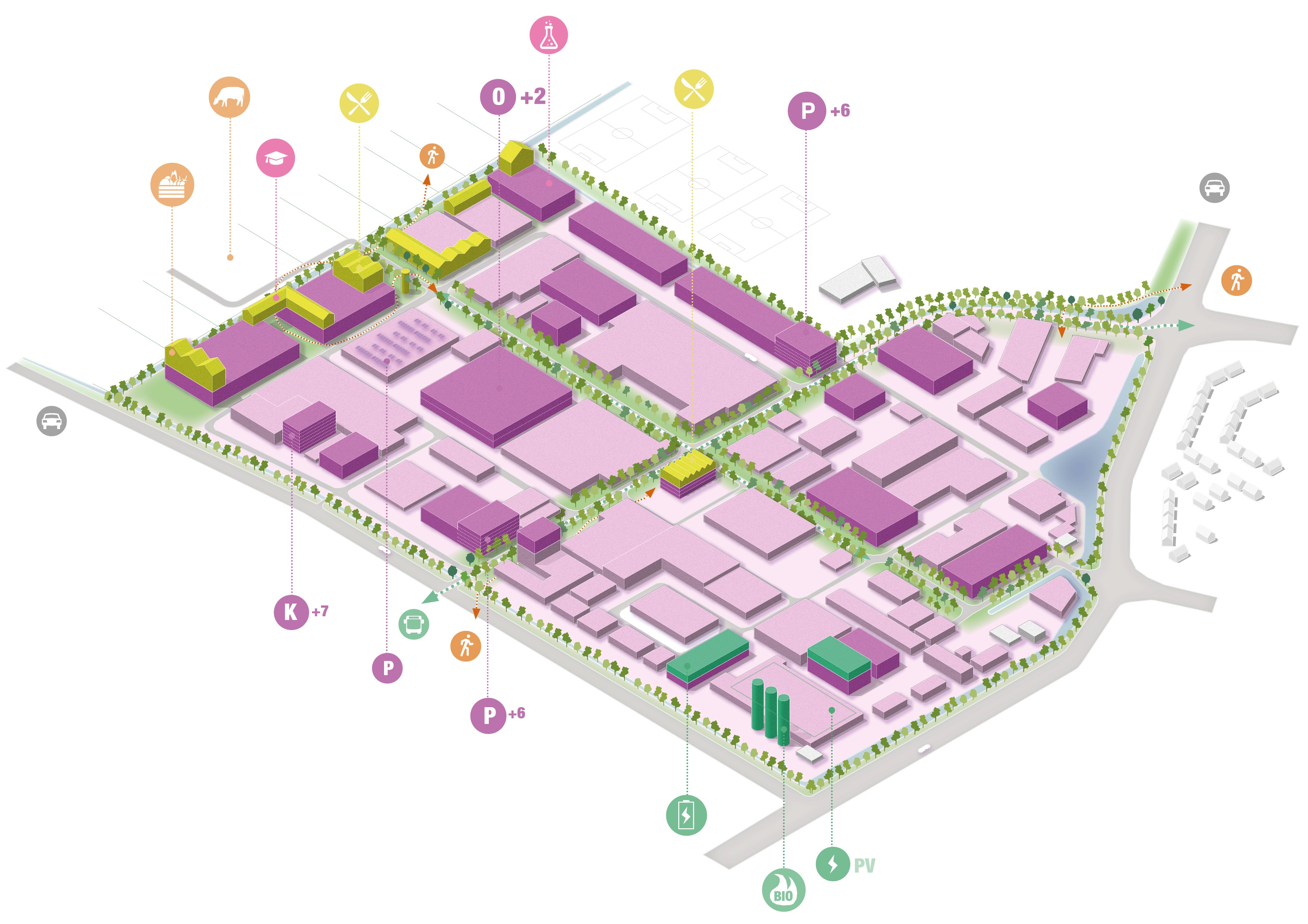
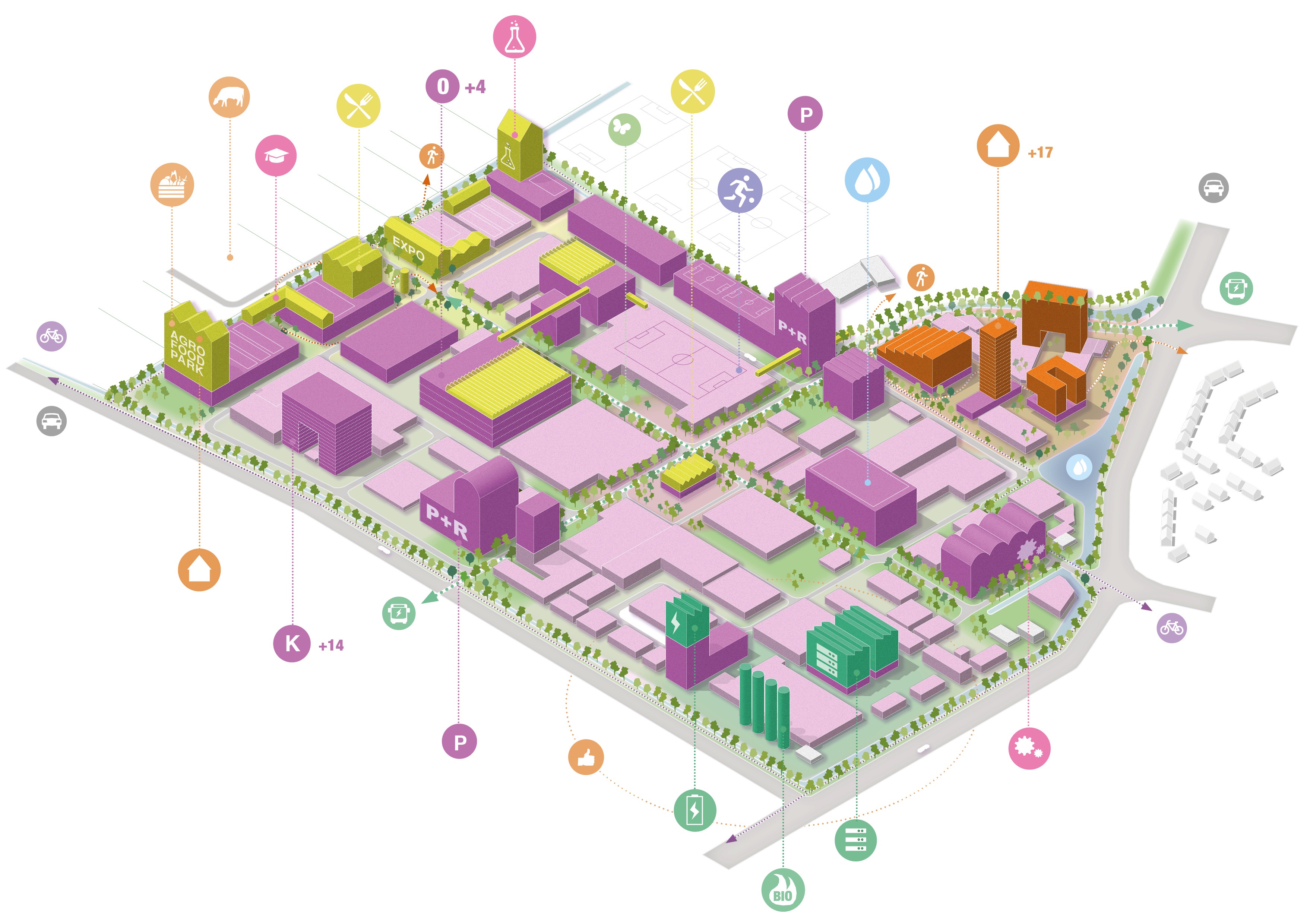
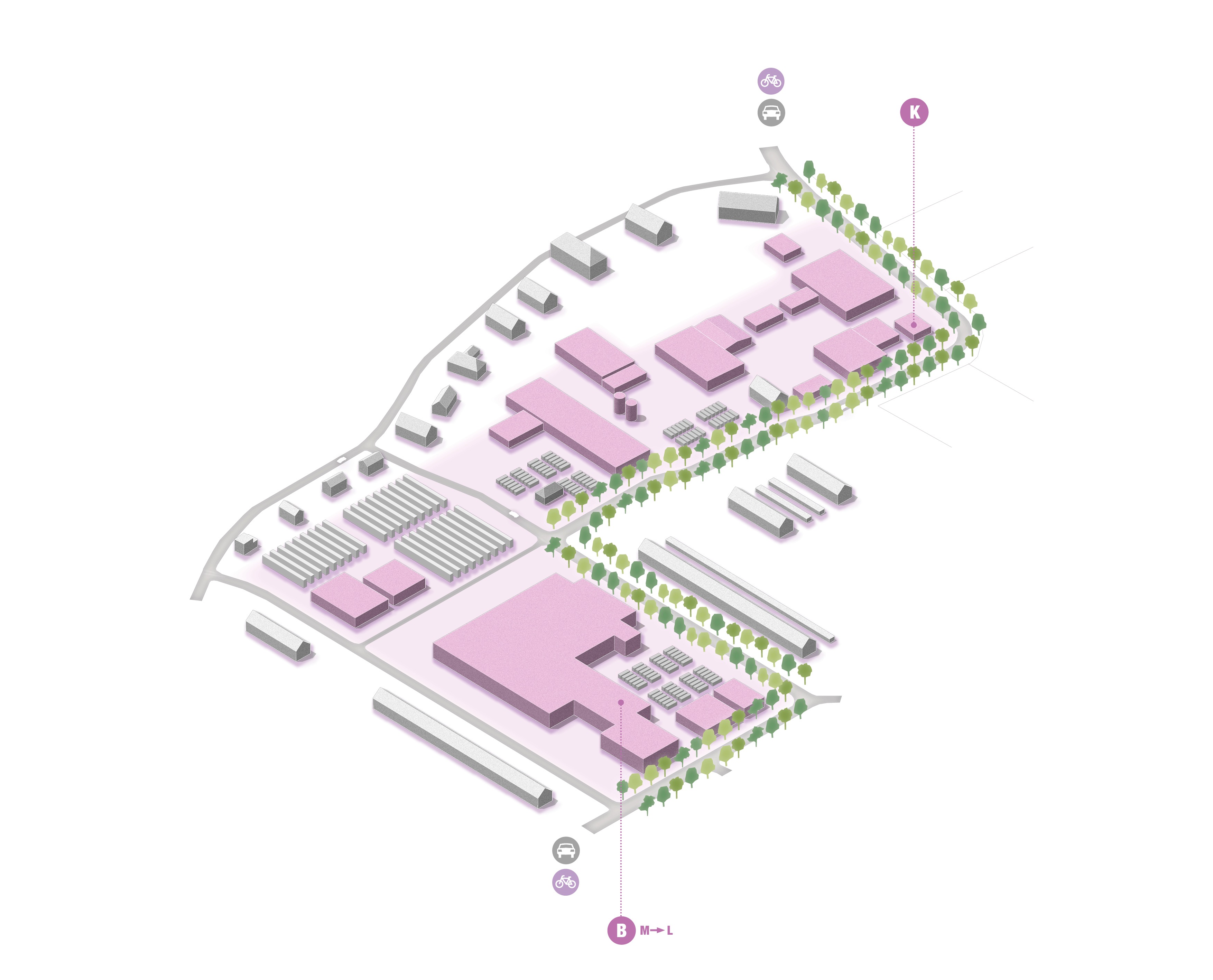
Schematic isometric view of an industrial area,
categorized as type L:
By sharing facilities, companies can make use of collective interests such as storage space and showrooms. However, concentrated intensification also creates space for recreation. The scale of the industrial estates lends itself to collective energy production and distribution. Many locations in the L category are stony and could use an upgrade when it comes to nature and amenity values. This can be done, for example, by adding greenery and public functions at ground level.
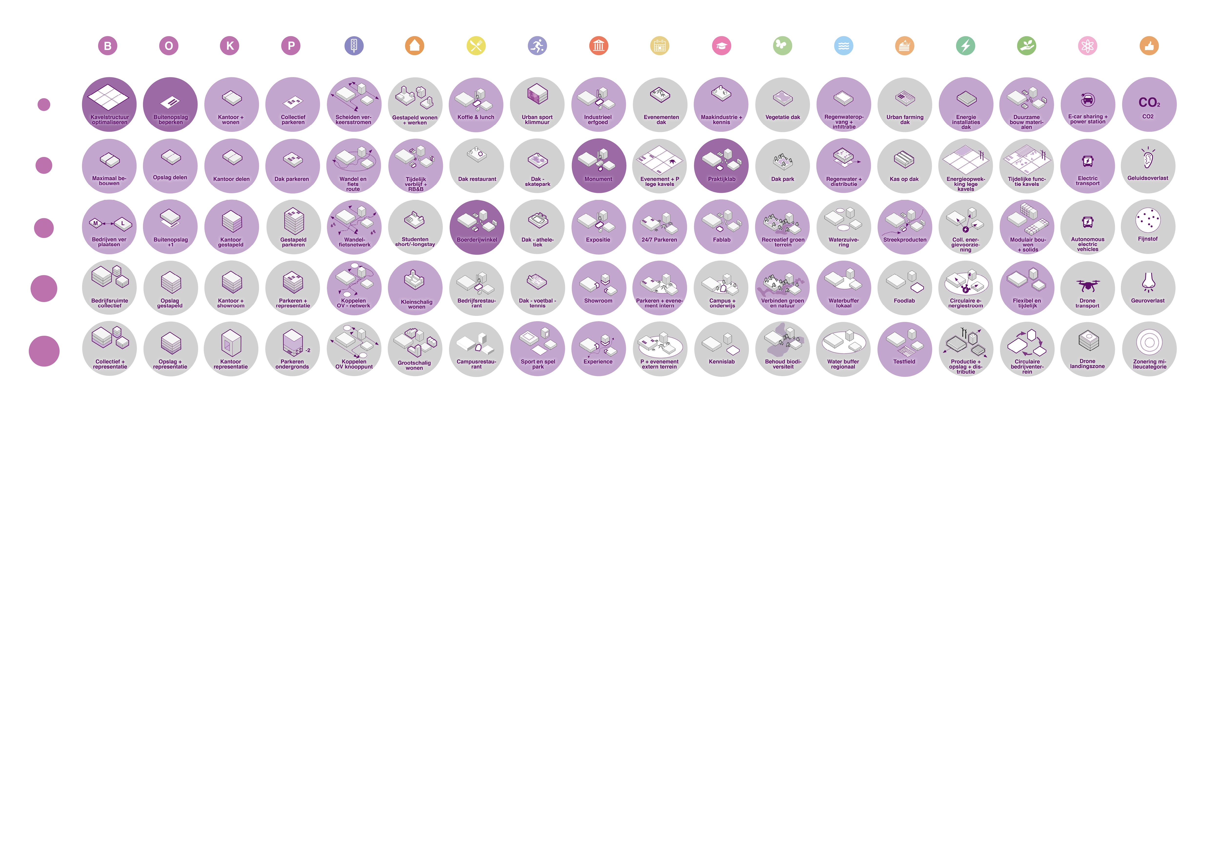
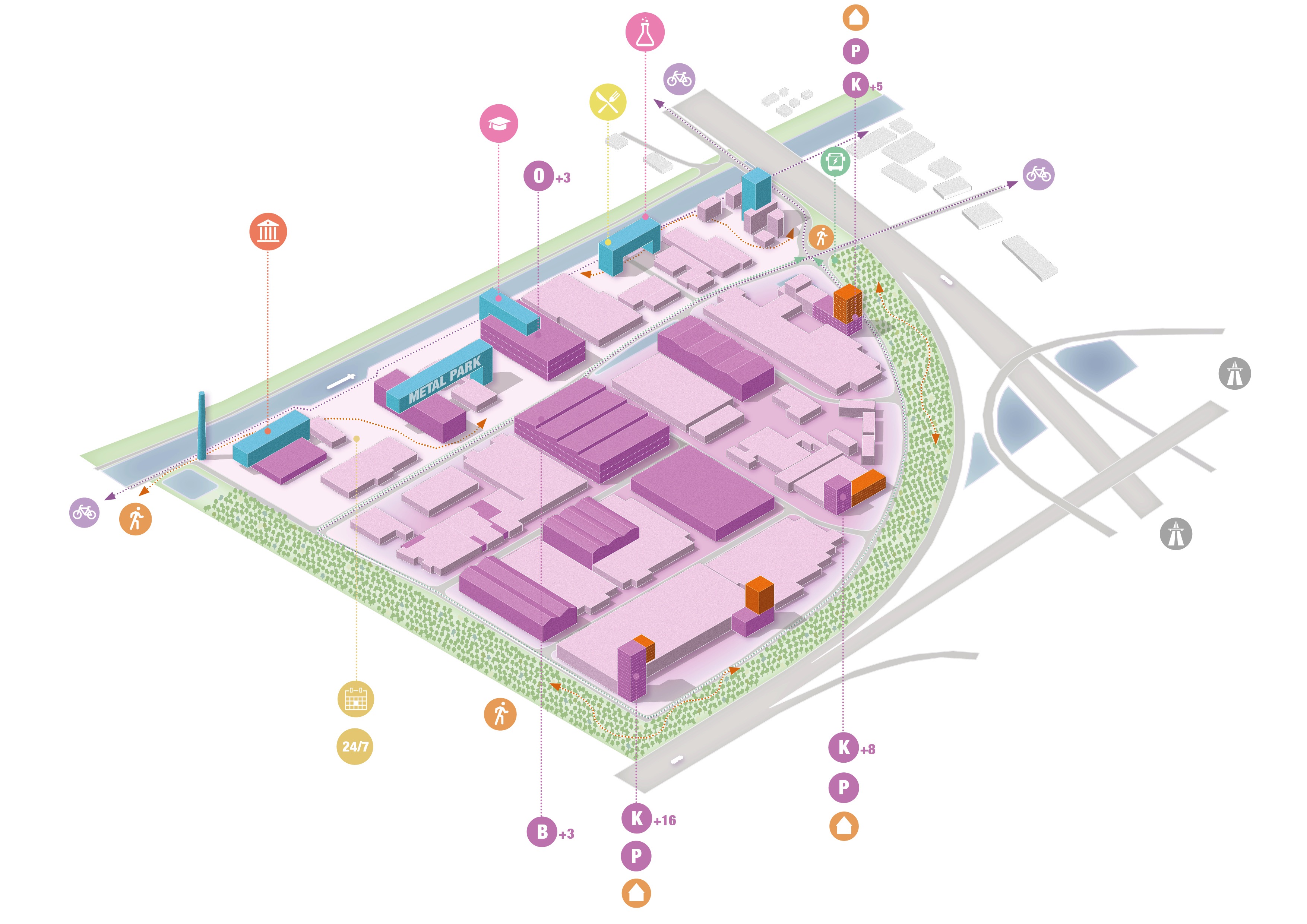
Schematic isometric view of an industrial area,
categorized as type S:
Because the scale and size of these industrial estates is limited, the interventions are at first sight less drastic. Adding many m2 of new activity is less important here. The focus is more on the smart combination of new functions, such as housing, manufacturing industry or collective use of public space. In addition, there is a challenge in preserving valuable cultural-historical heritage at these locations and in combining this with a new programme. This contributes to strengthening the identity of the location.
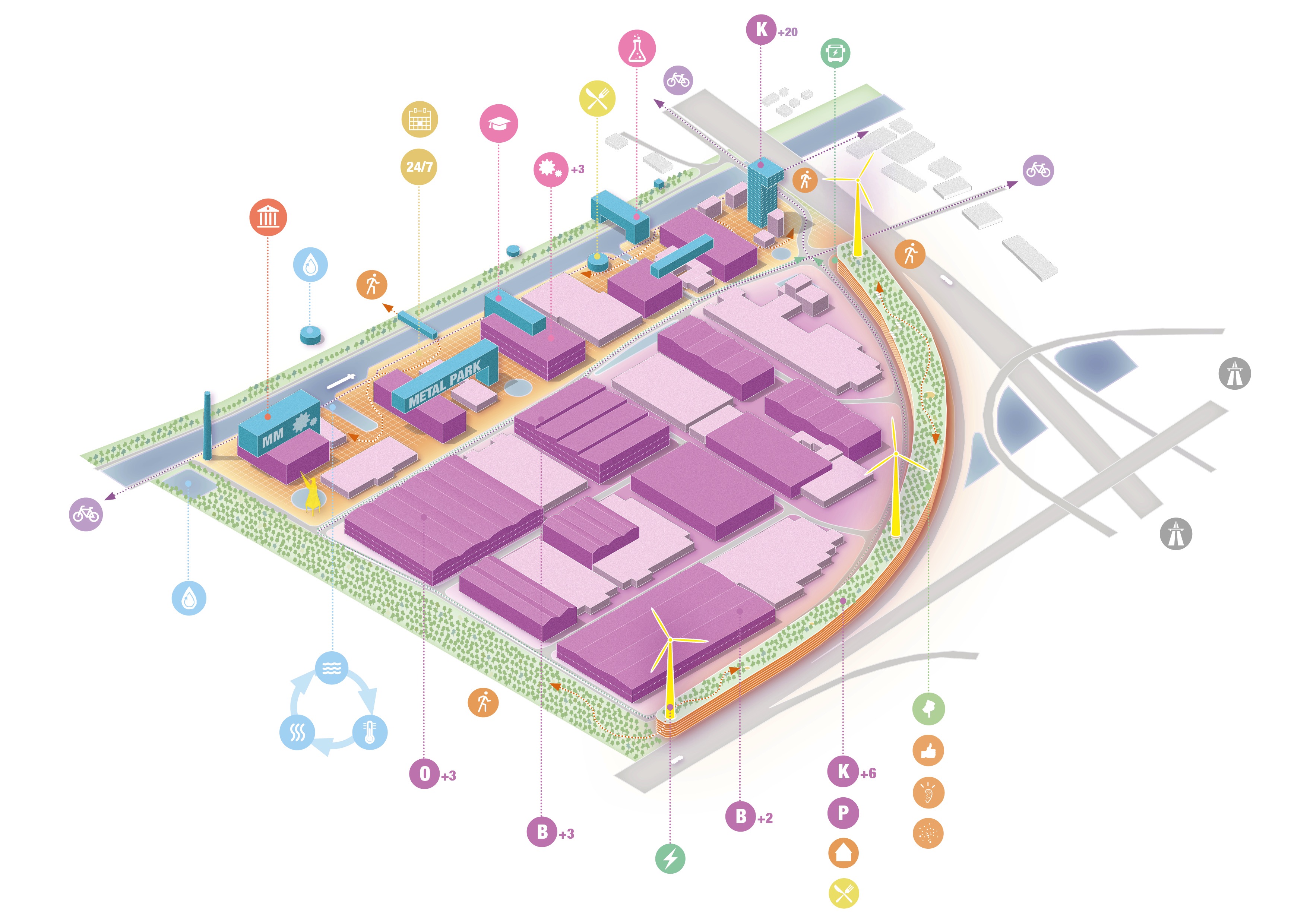
* Schematic isometric view of an industrial area,
categorized as type XL:
Flexibility and temporariness are used to allow companies to make more connections with the immediate environment. For example, by stimulating the ecology through temporary nature on (still) fallow sites. The XL locations offer an interesting learning place in the field of robotics, new building forms or manufacturing industry. Due to the distance to the residential area, these areas can be used as stepping stones in a nature network, or
as water storage outside the city.
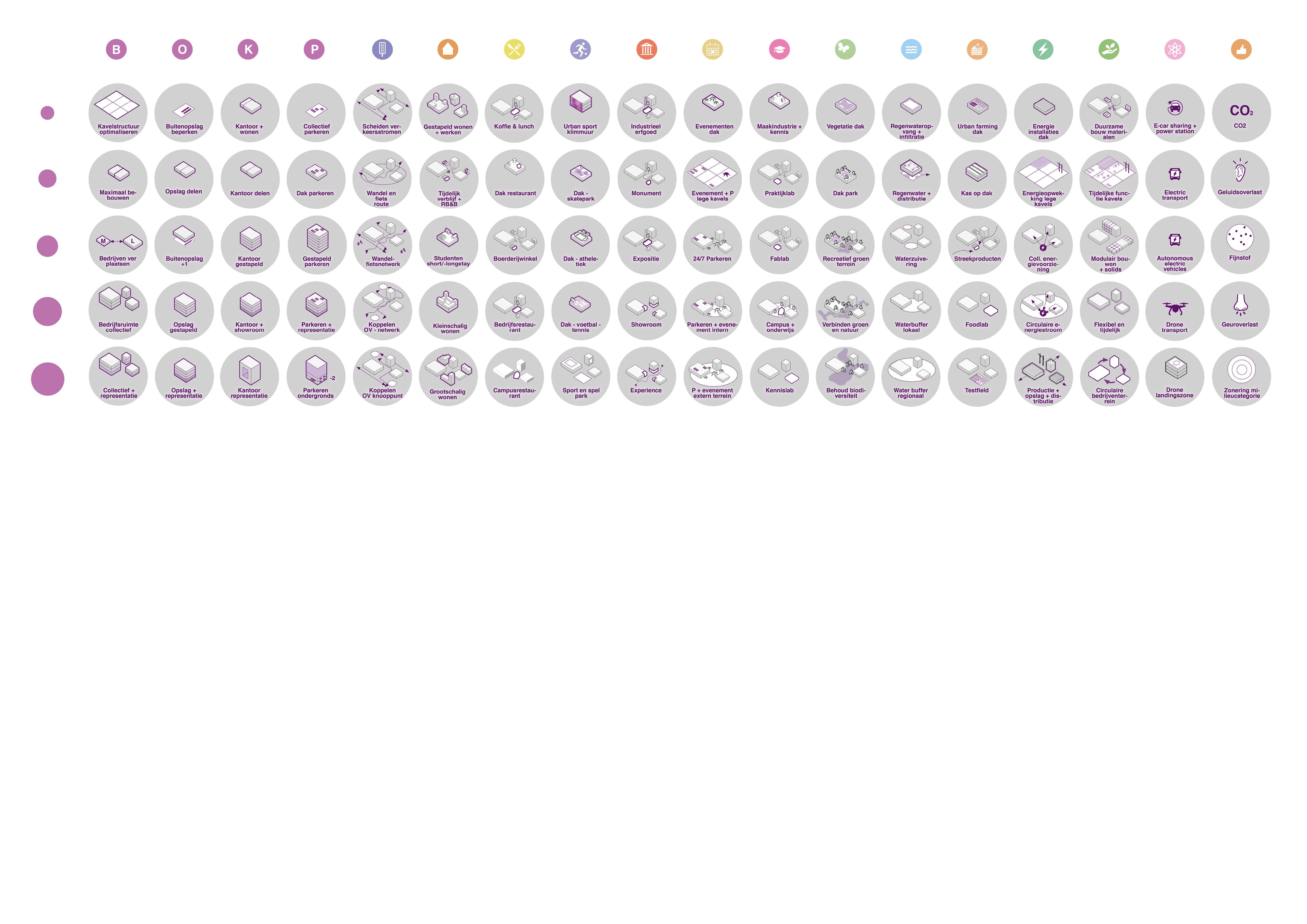
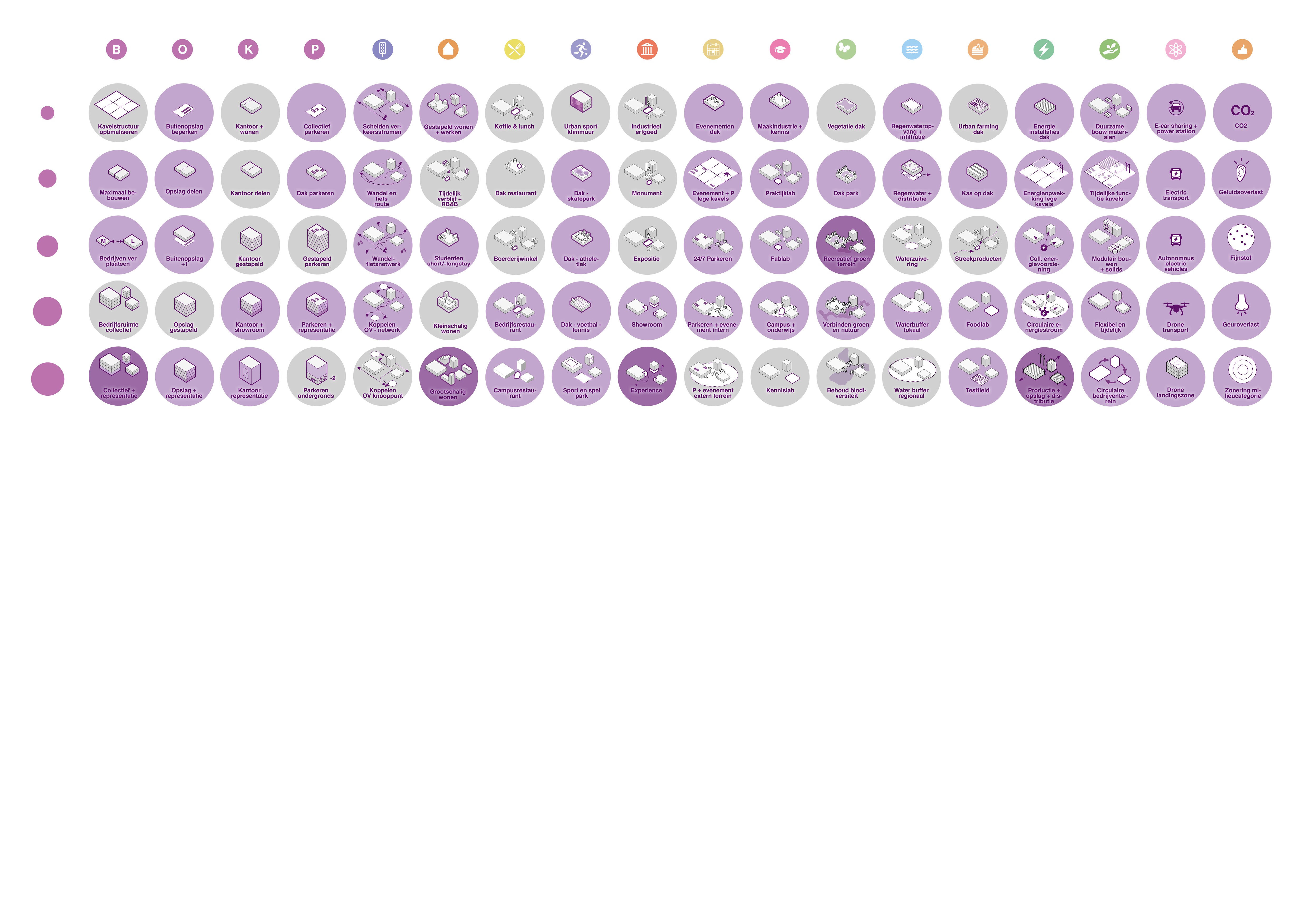
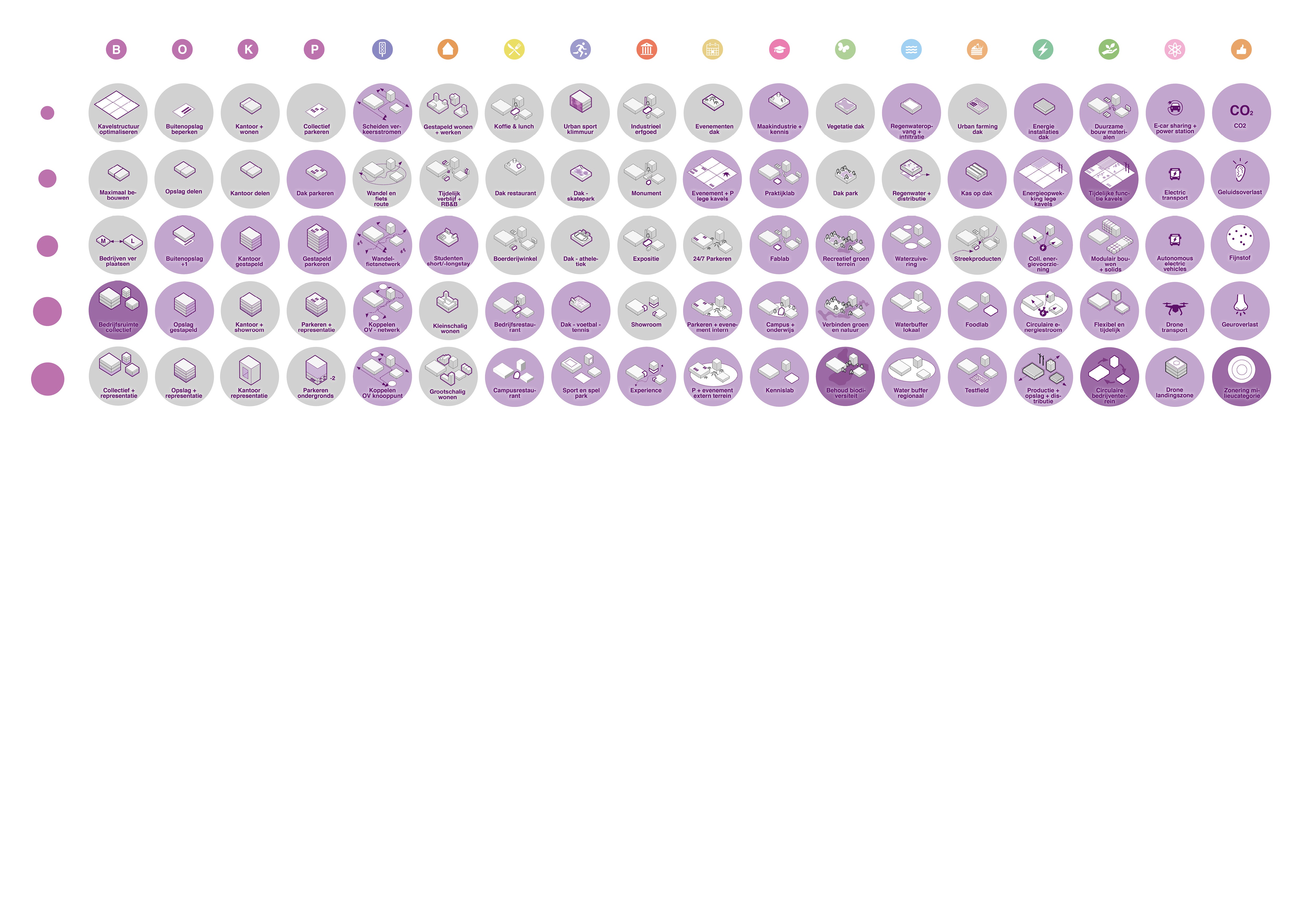
*Punch card:
A 'punch card' has been made for each location type: the interventions that qualify for this location type are marked in the matrix with a light purple color. The main inter-
Intensification vents for that location type
are marked with a dark purple color (the top 5).
The punched cards make the unique profile of the four location types transparent and comparable. The icons from the matrix are reflected in the test images with the different intensification degrees. This provides insight into which interventions are used per degree of intensification.